The sunset turns Francois Lake into a rippling sheet of orange-gold, where loons call across the water and families gather on docks that have weathered decades of northern British Columbia seasons. It’s this enduring connection between community and water that makes the current shoreline health survey so vital for this region.
“When my grandfather built our cabin in the 1950s, you could see straight to the bottom even in the deepest parts near shore,” says Ellen Thompson, whose family has spent summers at Francois Lake for three generations. “Now in some spots, the water’s clarity has changed dramatically.”
Thompson isn’t alone in noticing these shifts. Her observations are precisely why the Francois Lake Conservation Association has partnered with the Fraser Basin Council to conduct a comprehensive shoreline health assessment throughout the summer of 2023.
The 110-kilometer-long Francois Lake, one of the largest natural lakes in British Columbia, has experienced increasing development pressure and recreational use over the past two decades. What makes this survey different is its community-based approach that balances scientific data collection with local knowledge.
“People who’ve lived on this lake for decades hold an incredible baseline of knowledge that no satellite imagery or one-time assessment could capture,” explains Jordan Williams, aquatic ecologist with the Fraser Basin Council. “We’re blending their observations with standardized ecological assessments to create a more complete picture.”
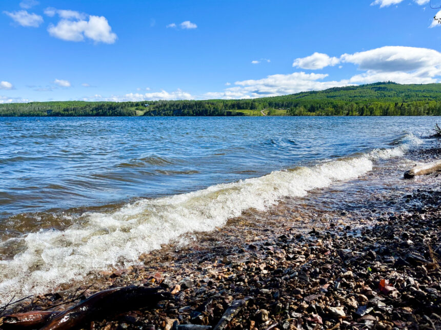
On a warm Tuesday morning, I join Williams and two local volunteers as they navigate a small aluminum boat along the northeastern shore. The team documents riparian vegetation, shoreline alterations, and wildlife habitat features while recording GPS coordinates at regular intervals.
At one stop, Williams carefully measures water clarity using a Secchi disk—a simple black and white circle that’s lowered into the water until it disappears from view. The deeper it remains visible, the clearer the water. Today’s reading: 4.2 meters.
“Historical data from the 1970s shows readings closer to 7 meters in this same area during summer months,” Williams notes, recording the measurement. “It’s not catastrophic, but it indicates changes we need to understand.”
The survey also examines how human activities affect the lake’s natural processes. Manicured lawns extending to the water’s edge, removal of native vegetation, and hardened shorelines with concrete or riprap all interrupt the natural filtering systems that maintain water quality.
According to the British Columbia Ministry of Environment, healthy riparian zones—the areas where land and water meet—provide critical ecological services including erosion control, water filtration, and habitat for nearly 80% of wildlife species in the region. These buffer zones become increasingly important as climate change brings more extreme weather events to northern BC.
Shoreline development regulations exist through the provincial Water Sustainability Act, but enforcement has been challenging across BC’s vast rural areas. A 2021 report from the Freshwater Alliance found that only about 30% of waterfront property owners fully understand how their land management practices affect water quality.
“We’re not about pointing fingers,” says Melissa Chen, president of the Francois Lake Conservation Association. “This survey helps us all understand where our lake is healthy and where it needs help. The goal is to work together to protect what makes this place special.”
The survey methodology draws from the Sensitive Habitat Inventory Mapping protocol developed by Fisheries and Oceans Canada, adapted to include traditional ecological knowledge from Wet’suwet’en and Carrier communities whose territories include Francois Lake.
“My grandfather taught me that you can read the health of the land in how the water moves and what grows along its edges,” says Robert Patrick, a Wet’suwet’en elder who advises the project. “Science is catching up to what our people have always known—everything is connected.”
Preliminary findings show that approximately 40% of the surveyed shoreline remains in near-natural condition, while about 25% shows significant alteration. The remaining 35% falls somewhere in between—modified but maintaining some ecological function.
For lakeside residents like Thompson, the survey provides practical guidance. After learning about the importance of native vegetation for preventing erosion, she’s replanting sections of her shoreline with willow and red-osier dogwood.
“It’s actually less work than trying to maintain a lawn to the water’s edge,” she explains. “And the birds love it.”
The Fraser Basin Council plans to use the survey results to create resources for property owners, including a restoration guide specific to Francois Lake’s ecosystem. They’ll also work with regional districts to inform future planning decisions around the lake.
Similar community-based environmental monitoring has shown promising results elsewhere in BC. On Kootenay Lake, a volunteer-supported shoreline mapping project led to a 30% increase in restoration projects and improved compliance with development regulations, according to the Living Lakes Canada network.
The Francois Lake project will continue through fall, with final results expected by spring 2024. For now, Williams and her team will keep methodically working their way around the lake’s 220-kilometer shoreline, documenting what they find and engaging residents along the way.
As our boat returns to the dock after a long day of surveying, a family arrives to spend the evening fishing. Their young daughter peers into the water, fascinated by minnows darting between rocks. It’s a reminder of what’s at stake.
“We’re doing this for her,” Williams says, nodding toward the child. “And for everyone who will know this lake in the decades to come.”